Manitoba Transportation and Infrastructure’s Hydrologic Forecast Centre is issuing an overland flood watch for all of southern and central Manitoba as forecasters continue to monitor a series of precipitation systems that could bring as much as 60 millimetres (mm) of rain to the region this week. Rain amounts of more than 60 mm are possible in some localized areas.
A second system this week, beginning Friday, has the potential to bring another 20 to 40 mm of rain, adding to the precipitation that already fell on Monday. Most ditches and waterways are either full or near capacity. Heavy rain occurring over a short period on saturated soil could create overland flooding. Water level forecasts will be updated to determine impacts from this precipitation on areas that are already experiencing flooding.
Flooding continues in the Interlake, Red River Valley and many other portions of central and southern Manitoba. Residents in these areas are advised to monitor local conditions and take any necessary flood mitigation actions.
Several communities throughout the province continue to be impacted by high water levels. The Manitoba Emergency Measures Organization (EMO) continues to work with all local authorities and emergency management partners to provide guidance and support for response and recovery activities.
Reported impacts to date include loss of road access, flooded properties and damage to infrastructure. As a result of these impacts, four municipal emergency operations centres have been activated and states of local emergency have been declared in 26 communities. Manitoba EMO continues to work with Indigenous Services Canada (ISC) in supporting ISC-led response measures with First Nation communities.
A flood warning is issued for Vermillion River as water levels are rising or near peak levels at some locations. A flood warning remains in place for most parts of the Red River north of Emerson (except Winnipeg), La Salle near Sanford, the Pembina, Boyne, Morris and Little Morris rivers and the Deadhorse, Shannon and Netley creeks, Fisher River, Icelandic River, Assiniboine River from the Shellmouth Dam to Brandon, the Whiteshell Lakes area and the Whitemouth and Birch rivers. A complete list of flood warnings, watches and high water advisories is available in the daily flood reports found at gov.mb.ca.
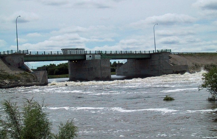
The Red River Floodway and the Portage Diversion continue to operate to lower water levels in Winnipeg. Flow in the floodway channel was near 40,000 cubic feet per second (cfs) this morning. Flows upstream of the floodway inlet this morning are approximately 80,000 cfs.
Manitobans are reminded to stay off waterways including creeks, streams, rivers and the floodway. High flows, debris and cold water temperatures present a significant safety risk. Members of the public are also asked to keep away from flooded areas, water control structures including dams and diversions, and areas where flood response crews are working.
Up-to-date information on highway conditions, including detours and road closures, is available at manitoba511.ca or by calling 511. Flood mitigation assistance can be directed to the municipal authority. In case of an emergency, residents are advised to contact 911.