The Manitoba Wildfire Service advises fire and travel restrictions will increase to Level 3 in the southeastern regions including areas 1, 2 and 3 resulting in a full fire ban in effect and all backcountry travel prohibited. In Area 5, the level will increase to Level 2, which allows non-motorized travel. Fire and travel restrictions are cancelled in Area 7 due to recent precipitation and improved conditions. Fireworks and lanterns are prohibited under a Level 3 restriction and require a permit during the wildfire season. Refer to the areas and further details of the fire and travel restriction map found at gov.mb.ca.
The Manitoba Wildfire Service (MWS) continues to respond to 16 active wildfires across the province, a total of 81 wildfires to date, and continues to respond to the following fires of note:
West Region:
- Fire WE044, located near Big Eddy west of The Pas, is 40,161 hectares (ha). MWS is working with local fire departments and using thermal scanning to target hotspots and making good progress.
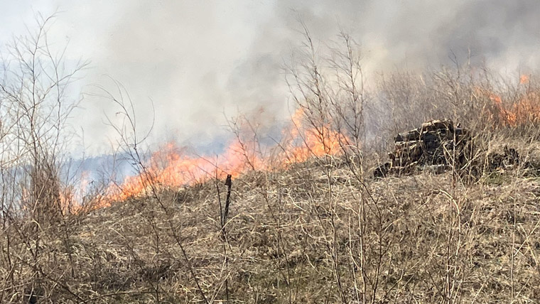
East Region:
- Fire EA057, located near Carrick, is approximately 7,000 ha. Crews, heavy equipment and helicopters are assigned and targeting key areas. Value protection is set up for at-risk properties. Local fire departments are assisting.
- Fire EA059, located two kilometres from Libau, is approximately 5,000 ha. East Selkirk Fire Department is targeting areas of concern and protecting values. The Office of the Fire Commissioner (OFC) and MWS are assisting as needed.
- Fire EA061, located one km from Bird River, is approximately 100,000 ha. Highway 315 is closed and blocked at Bird River. Highway 314 is closed and blocked at Bissett. Bernic Lake Mine has been evacuated. All residents in the impacted areas have been evacuated. Value protection is being established in areas where it is safe to work.
- Fire EA062, located six km from Lac du Bonnet, is approximately 4,000 ha. Residential evacuation is in place. Local fire departments, OFC and MWS are coordinating their efforts.
- Fire EA063, located on the Ontario border near Ingolf, is approximately 4,000 ha. This fire originated in Ontario and is also numbered as KEN#020. An evacuation order is in place. Municipal fire departments, OFC and MWS are coordinating their efforts. The 4,000 ha is the approximate size of the Manitoba portion of the fire.
Travellers on the Trans-Canada Highway and Ontario Highway 17 east to Kenora are being advised to take extra precautions while travelling in smoky conditions. The best way to keep safe is to delay non-essential trips if possible. If travel is required, be alert and do not speed. Increase vehicle-following distance to four to six seconds, similar to driving in winter conditions. Keep vehicle windows rolled up and air circulating inside the vehicle. Avoid driving at night as the combination of temperature, moisture, dim lighting and smoke can reduce visibility.
Many municipalities have proactively implemented burning restrictions this spring so check with the local municipal office or view the interactive burning restrictions map at manitoba.ca for more information. No burning permits will be issued for areas within or bordering any municipality where burning restrictions are already in place.
For further information on the Manitoba Wildfire Service, situation updates, restrictions and other important wildfire links, visit gov.mb.ca. To report a wildfire, call 911 or the TIP line toll-free at 1-800-782-0076.