The Manitoba Wildfire Service advises the province is at a moderate-to-high fire danger and anticipates fires caused by lightning starts. Manitobans are reminded to continue to act with great caution when outdoors. Human-caused fires unnecessarily put people and communities at risk but are preventable.
Fire and travel restrictions
Areas 1 to 5 and areas 8 to 22 are at Level 2. This means:
- Provincial burning permits are cancelled. Burn permits may be issued for agriculture and industry under the discretion of a conservation officer and Manitoba Wildfire Service.
- Motorized backcountry travel, including ATVs and other off-road vehicles, is prohibited unless under the authority of a travel permit. For travel permit requests, call 204-345-1489.
- Travel permit is required for remote travel within the boundaries of a fire.
- Camping is restricted to developed campgrounds.
- Campfires are only permitted between the hours of 8 p.m. and 8 a.m.
- Wayside parks remain open.
- Landing and launching is restricted to developed shorelines only.
- Industry and outfitters may be restricted in their operations and should contact their local National Resources and Indigenous Futures office for more information.
Many provincial parks fall within burn areas 1 to 5 and 8 to 22, and are considered at Level 2 including the Whiteshell, Grand Beach, Hecla/Grindstone, Duck Mountain, Clearwater Lake and Paint Lake.
Fire and travel restrictions have been lifted for areas 6, 7 and Area A, which includes the following provincial parks: Asessippi, Beaudry, Birds Hill, Camp Morton, Duff Roblin, Grand Valley, Hnausa Beach, Hyland, Lockport, Lundar Beach, Manipogo, Margaret Bruce, Memorial, Netley Creek, Norris Lake, Oak Lake, Pembina Valley, Portage Spillway, Rainbow Beach, River Road, Rivers, Seton, St. Ambroise Beach, St. Malo, St. Norbert, Stephenfield, Trappist Monastery, Upper Fort Garry, Watchorn, William Lake, Winnipeg Beach and Yellow Quill.
Several provincial parks or park areas remain closed to all park users, including Bakers Narrows, Manigotagan River, South Atikaki, Wallace Lake, with partial closures in Whiteshell and Nopiming. Check manitobaparks.com for details and updates.
Anyone returning to reopened areas is advised to be prepared to evacuate again with little notice and should prepare an emergency go kit, as well as remain alert for evacuation notices.
Manitoba continues under a provincewide state of emergency. The provincial state of emergency under the Emergency Measures Act is in effect until June 26.
Since May 1, the Manitoba Conservation Officer Service has issued 93 charges and 31 warnings related to wildfires.
Fires of note
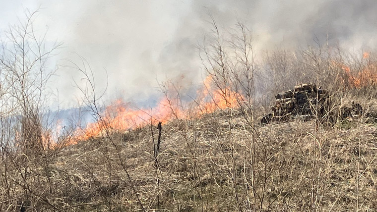
The Manitoba Wildfire Service continues to respond to 21 active wildfires across the province, a total of 125 wildfires to date, above the average for this date of 120 total fires. Total area burned in the province is more than 902,000 hectares (ha).
East region:
- Fire EA061 remains out of control at approximately 218,700 ha. Provincial Road (PR) 315 is open with access to Bird Lake, Booster Lake, Flanders Lake and Davidson Lake. A closure and mandatory evacuation order continues for the rest of Nopiming Provincial Park and the entire areas of Wallace Lake, South Atikaki and Manigotagan River provincial parks. PR 314 remains closed through Nopiming Provincial Park. The two-hour evacuation notice has been lifted for the Rural Municipality of Alexander from Tall Timber Road to Hill Drive.
- Fire EA063, located on the Ontario border near Ingolf, is being held at approximately 5,400 ha. A closure order continues for the Mantario Wilderness Zone in Whiteshell Provincial Park and the Caddy Lake tunnels are closed.
West region:
- Fire WE017, located near Sherridon and the city of Flin Flon, is approximately 370,780 ha and is out of control. Mandatory evacuation orders remain in place for Big Island, Schist Lake, Little Athapapuskow Cottage Area, Whitefish, White Lake (northwest region), Bakers Narrows Provincial Park and the city of Flin Flon.
- Fire WE023, located eight kilometres (km) from Wanless and south of Cranberry Portage, is approximately 4,920 ha and is under control.
- Fire WE025, located near Mathias Colomb Cree Nation (Pukatawagan), is approximately 55,140 ha and is being monitored. The fire around Mathias Colomb Cree Nation is contained but a mandatory evacuation order continues for Mathias Colomb Cree Nation (Pukatawagan).
- Fire WE027, located eight km from the town of Grand Rapids and Misipawistik Cree Nation, is approximately 12,000 ha and is being held.
- Fire WE028, located 10 km from Bakers Narrows Provincial Park, is approximately 7,200 ha and is out of control.
North region:
- Fire NO002, located near the town of Lynn Lake, is approximately 71,860 ha and is out of control. A mandatory evacuation order continues for the town of Lynn Lake and Marcel Colomb First Nation (Black Sturgeon).
- Fire NO005, located near Pimicikamak Cree Nation (Cross Lake), the Incorporated Community of Cross Lake, Jenpeg Generating Station and Whiskey Jack Landing, is approximately 64,860 ha and is out of control.
- Fire NO010, located near Tataskweyak Cree Nation (Split Lake), is approximately 21,560 ha and is out of control.
To report a wildfire, call 911 or the TIP line toll-free at 1-800-782-0076.