The town of Lynn Lake has started evacuating to Brandon due to a potential loss of power related to wildfires. This mandatory evacuation will affect 579 residents. Lynn Lake evacuees are asked to attend the evacuation reception centre in Brandon at the Victoria Inn, 3550 Victoria Ave., which is operating 24 hours a day, seven days a week.
The Manitoba Wildfire Service advises the southern and very northern areas of the province have a low-to-moderate fire danger level. The west and northeast areas have a high-to-very-high fire danger, with some pockets of extreme fire danger.
While fire and travel restrictions have been lifted for most of the province, travel permits are required for travel within an active fire boundary. To view active fire boundary maps, visit gov.mb.ca. To apply for a travel permit, contact a Natural Resources and Indigenous Futures district office and visit gov.mb.ca to find a location.
Manitoba Parks advises visitors to check manitobaparks.com for the latest information before heading to a provincial park.
Since May 1, the Manitoba Conservation Officer Service has issued 96 charges and 32 warnings related to wildfires.
Fires of note
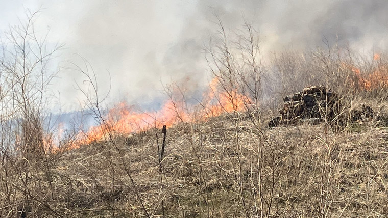
The Manitoba Wildfire Service continues to respond to 64 active wildfires across the province, a total of 205 wildfires to date, above the average for this date of 176 total fires.
East region:
- Fire EA061 remains out of control at approximately 251,680 ha. Provincial Road (PR) 315 is open with access to Bird Lake, Booster Lake, Flanders Lake and Davidson Lake. A closure and mandatory evacuation order continues for parts of Nopiming Provincial Park and the entire areas of Wallace Lake and South Atikaki provincial parks. PR 314 remains closed through Nopiming Provincial Park.
West region:
- Fire WE017, located near Sherridon and the city of Flin Flon, is approximately 370,780 ha and is out of control. The Flin Flon airport at Bakers Narrows has re-opened. For the safety of personnel, boaters are asked to avoid waterways being utilized by Manitoba Wildfire Service tankers and aircraft.
- Fire WE025, located near Mathias Colomb Cree Nation (Pukatawagan), is approximately 59,220 ha and is being monitored. The fire around Mathias Colomb Cree Nation is contained but a mandatory evacuation order continues for Mathias Colomb Cree Nation (Pukatawagan).
- Fire WE028, located 10 kilometres (km) from Bakers Narrows Provincial Park, is approximately 7,200 ha and is out of control.
North region:
- Fire NO002, located near the town of Lynn Lake, is approximately 80,120 ha and is out of control.
- Fire NO005, located near Pimicikamak Cree Nation (Cross Lake), the Incorporated Community of Cross Lake, Jenpeg Generating Station and Whiskey Jack Landing, is approximately 66,825 ha and is out of control.
- Fire NO010, located near Tataskweyak Cree Nation (Split Lake), is approximately 22,275 ha and is being held.
- Fire NO026, located 14 km from the town of Leaf Rapids, is approximately 5,165 ha and is out of control.
- Fire NO042, located 14 km southwest from the town of Lynn Lake, is approximately 6,000 ha and is out of control. A mandatory evacuation order is in place for the town of Lynn Lake.
- Fire NO047, located 26 km from Leaf Rapids, is approximately 2,000 ha and is out of control.
To report a wildfire, call 911 or the TIP line toll-free at 1-800-782-0076.