The Manitoba Wildfire Service advises that as fire danger remains high to very high across much of the province, the provincial state of emergency has been extended until August 22, 2025. Some areas may see brief relief from wildfire activity due to rain, but storm activity also brings the risk of more lightning starts.
Manitoba Wildfire Service has cancelled all burn permits for the Burn Permit Area, with no new burn permits issued at this time. Land-based travel is permitted, unless closed by Parks or other closure orders. Those entering a fire boundary by aircraft will require a travel permit. To view active fire boundary maps, visit gov.mb.ca. To apply for a travel permit, contact a Natural Resources and Indigenous Futures district office and visit gov.mb.ca to find a location.
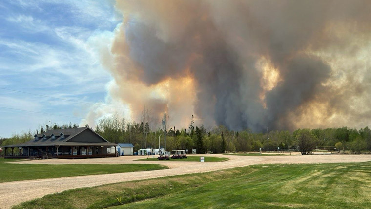
Manitoba remains under a provincial state of emergency, under the Emergency Measures Act due to a wildfire season that is now the worst on record in the past 30 years, with more than 1.55 million hectares (ha) of area burned in the province.
For updates on park closures, visit manitobaparks.com.
Fires of note
The Manitoba Wildfire Service continues to respond to 159 active wildfires across the province, bringing the total to 403 wildfires to date, well above the average of 305 fires for this time of year.
East region:
- Fire EA061 remains out of control at approximately 331,990 ha. A closure and mandatory evacuation order is in place for most of Atikaki Provincial Park, and the entire areas of Wallace Lake and South Atikaki provincial parks. While access to Nopiming Provincial Park has reopened, the fire continues to smoulder throughout the park.
West region:
- Fire WE017, located near Sherridon and the city of Flin Flon, is approximately 371,900 ha and is out of control. For the safety of personnel, boaters are asked to avoid waterways being utilized by Manitoba Wildfire Service tankers and aircraft.
- Fire WE025, located near Mathias Colomb Cree Nation (Pukatawagan), is approximately 122,445 ha and is being monitored. The fire is contained around Mathias Colomb Cree Nation (Pukatawagan) but a mandatory evacuation order continues.
- Fire WE028, located 10 kilometres (km) from Bakers Narrows Provincial Park, is approximately 7,190 ha and is out of control.
- Fire WE052, located near Snow Lake is approximately 57,765 ha and is out of control.
- Fire WE085, located about nine km from Cormorant, is approximately 4,560 ha and is out of control. A mandatory evacuation order is in place.
North region:
- Fire NO002, located near the town of Lynn Lake, is approximately 84,270 ha and is out of control.
- Fire NO042, located 12 km southwest from the town of Lynn Lake, is approximately 15,090 ha and is out of control. A mandatory evacuation order is in place for the town of Lynn Lake and Marcel Columb First Nation.
- Fire NO005, located near Pimicikamak Cree Nation (Cross Lake), the Incorporated Community of Cross Lake, Jenpeg Generating Station and Whiskey Jack Landing, is approximately 179,510 ha and is out of control.
- Fire NO010, located near Tataskweyak Cree Nation (Split Lake), is approximately 25,225 ha and is out of control.
- Fire NO026, at the town of Leaf Rapids, is approximately 73,540 ha and is out of control. A mandatory evacuation order is in place for the town of Leaf Rapids.
- Fire NO047, located 25 km from the town of Leaf Rapids, is approximately 15,525 ha and is out of control.
- Fire NO061, located 14 km from the city of Thompson, is approximately 18,365 ha and is out of control.
- Fire NO079 located near Kistiganwacheeng (Garden Hill Anisininew Nation), is approximately 37,855 ha and is out of control.
- Fire NO197 located nine km from Minithayinikam (St. Theresa Point Anisininew Nation), is approximately 150 ha and is out of control.
To report a wildfire, call 911 or the TIP line toll-free at 1-800-782-0076.