The Manitoba Wildfire Service advises there is a low fire danger in the majority of the province, with a moderate fire danger level in the central and eastern areas.
Kistiganwacheeng (Garden Hill Anisininew Nation) began returning home on Aug. 12 and Nisichawayasihk Cree Nation (Nelson House) began returning home on Aug. 13.
As of Aug. 18, the primary wildfire evacuation reception centre in Winnipeg is now located at the Holiday Inn at 1740 Ellice Ave. The reception centre’s hours are 8:30 a.m. to 11:30 p.m., seven days a week until further notice. Evacuees can attend this location to register with the Canadian Red Cross, and access supports and services. Evacuees can also call 1-800-863-6582. The reception centre at the RBC Convention Centre is now closed.
The Manitoba Wildfire Service has cancelled all burn permits for the Burn Permit Area, with no new burn permits issued at this time. Land-based travel is permitted, unless closed by Manitoba Parks or other closure orders. Those entering a fire boundary by aircraft will require a travel permit. To view active fire boundary maps, visit gov.mb.ca. To apply for a travel permit, contact a Natural Resources and Indigenous Futures district office and visit gov.mb.ca to find a location.
Manitoba remains under a provincial state of emergency, under the Emergency Measures Act due to a wildfire season that is now the worst on record in the past 30 years, with more than 1.99 million hectares (ha) of area burned in the province to date. The provincial state of emergency is in place until Aug. 22.
Atikaki, South Atikaki and Wallace Lake provincial parks have reopened to all park users. While fires EA061 and EA096 continue to burn in Atikaki, all major wilderness water routes are accessible. For updates on park closures visit manitobaparks.com.
Fires of note
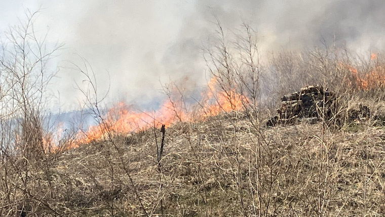
The Manitoba Wildfire Service continues to respond to 153 active wildfires across the province, bringing the total to 417 wildfires to date, well above the average of 331 fires for this time of year.
East region:
- Fire EA061 remains out of control at approximately 359,040 ha. While access to Atikaki and Nopiming provincial parks has reopened, the fire continues to smoulder throughout the parks.
West region:
- Fire WE017, located near Sherridon and the city of Flin Flon, is approximately 371,900 ha and is out of control. For the safety of personnel, boaters are asked to avoid waterways being utilized by Manitoba Wildfire Service tankers and aircraft.
- Fire WE025, located near Mathias Colomb Cree Nation (Pukatawagan), is approximately 122,445 ha and is being monitored. The fire is contained around Mathias Colomb Cree Nation (Pukatawagan) but a mandatory evacuation order continues.
- Fire WE028, located six kilometres (km) from Bakers Narrows Provincial Park, is approximately 7,190 ha and is out of control.
- Fires WE052 and WE089, located near Snow Lake are approximately 63,875 ha and 4,570 ha respectively, and are out of control. A mandatory evacuation order is in place for the town of Snow Lake. A closure and mandatory evacuation order remain for Wekusko Falls Provincial Park.
- Fire WE085, located about 10 km from Cormorant, is approximately 4,560 ha and is out of control.
North region:
- Fire NO002, located near the town of Lynn Lake, is approximately 85,690 ha and is out of control.
- Fire NO042, located 12 km southwest from the town of Lynn Lake, is approximately 21,725 ha and is out of control. A mandatory evacuation order is in place for the town of Lynn Lake and Marcel Columb First Nation.
- Fire NO005, located near Pimicikamak Cree Nation (Cross Lake), the Incorporated Community of Cross Lake, Jenpeg Generating Station and Whiskey Jack Landing, is approximately 179,510 ha and is out of control.
- Fire NO010, located near Tataskweyak Cree Nation (Split Lake), is approximately 25,225 ha and is out of control.
- Fire NO026, at the town of Leaf Rapids, is approximately 176,275 ha and is out of control. A mandatory evacuation order is in place for the town of Leaf Rapids.
- Fire NO047, located 25 km from the town of Leaf Rapids, is approximately 44,585 ha and is out of control.
- Fire NO061, located 14 km from the city of Thompson, is approximately 22,760 ha and is out of control.
- Fire NO079 located near Kistiganwacheeng (Garden Hill Anisininew Nation), is approximately 37,855 ha and is out of control. The mandatory evacuation order for Kistiganwacheeng (Garden Hill Anisininew Nation) and the Island Lake (Stevenson Island) area was lifted Aug. 12.
- Fire NO197 located nine km from Minithayinikam (St. Theresa Point Anisininew Nation), is approximately 150 ha and is out of control.
To report a wildfire, call 911 or the TIP line toll-free at 1-800-782-0076.