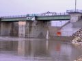
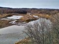
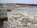
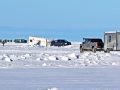
The province has issued a high water warning for the Red River south of Winnipeg and is preparing to activate the Red River Floodway to manage water levels within the city of Winnipeg.
The Manitoba government is releasing a Basins Condition Report to provide a snapshot of soil moisture and river levels across the province at this time.
The province has released its report on the Red River Floodway operation this past fall.
Manitoba Infrastructure has announced compensation for eligible applicants related to property damage or economic losses resulting from the operation of the Red River Floodway from Oct. 9 to Nov. 7 under Guideline 4, Emergency Operation to Reduce Sewer Backup in Winnipeg.
Manitoba Infrastructure’s Hydrologic Forecast Centre reports the Red River Floodway gates were lowered to their storage position this week, concluding the 2019 fall floodway operation under Guideline 4.
Due to recent heavy rains and rising water levels, the riverwalk at The Forks may be forced to close temporarily.
Given the uncertainty around ice conditions on the Red River, combined with higher expected temperatures and cautions about high water moving north from the United States, anglers are asked to have their ice-fishing shelters removed from the Red River as soon as possible, buy no later than Sunday, March 12.
Manitoba Infrastructure’s Hydrologic Forecast Centre is advising people to stay off the Red River in the Winnipeg area as high water from the United States makes its way north, raising river levels between eight to 10 feet, possibly weakening and breaking the ice.
Manitoba Infrastructure reminds river users to observe warning signs and stay clear of equipment as ice-cutting machines and icebreakers take to the north Red River between Netley Creek and Netley Lake north of Selkirk starting today.
On Saturday, October 22 at approximately 1pm, Selkirk RCMP responded to a call of possible human remains located along the banks of the Red River near Highway 212 and 204.